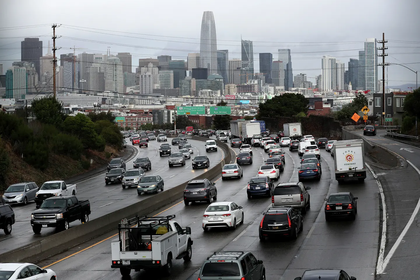
Anyone who drives regularly in the Bay Area knows its persistent traffic choke points, from key stretches of Highway 101 and Interstate 880 to the tangled intersection of Octavia and Market streets in San Francisco. It’s a frustrating, time-wasting problem, and Google researchers have been toying with a seemingly simple solution: just redirect some of those drivers down alternate routes.

Over a period of six months (the exact dates of the study are not specified), a team at Google’s research arm used Google Maps to reroute a small portion of drivers in 10 U.S. cities including San Francisco and Los Angeles. Through their experiment, which was published in the journal Nature Cities in June, the researchers sought to evenly spread traffic down more corridors as the drivers head to similar destinations, in the hopes of reducing congestion. The experiments nudged up vehicle speeds by 2% on average on the congested roads, and shortened travel times by a modest 0.7%. Scientists have long thought that traffic could be eased this way, and this now demonstrates how it could actually work in the real world.
“If you split traffic, because there’s not a single way to go from A to B, you are able to reduce congestion locally but also reduce CO2 emissions along the way,” said Alexandre Bayen, a co-author of the study and director of UC Berkeley’s Center for Information Technology Research in the Interest of Society. “This paper is the first time, to our knowledge, that this was done in practice, at scale, and in a variety of cities.” Bayen, along with all of his co-authors, worked at Google Research over the course of this project.
Advertisement
Article continues below this ad
Studying traffic flows
Making use of Google Maps data, Bayen and his colleagues picked about 100 road segments to study in each city, selecting spots that are particularly jammed during periods of peak demand or that act as bottlenecks, restricting the flow of traffic. In San Francisco, for example, they diverted a slice of drivers from Highway 101 onto Interstate 280. The detour slightly shortened the drive times of those left on 101 by about 30 seconds or more, while adding a bit more time to the commutes of their rerouted counterparts.

An example of how the researchers rerouted some drivers to an alternative path.
The researchers collected data on weekdays in the 10 cities, which included Seattle, Salt Lake City, Chicago and Atlanta. While they studied a variety of types of roads, from city streets to highways, they found that in cities such as Los Angeles where they targeted highways, their diversions had the biggest effect, with driving speeds in those areas increasing by about 4.6%. Most cities, though, saw a smaller improvement with speeds across them increasing by just 0.5% during peak times.
Advertisement
Article continues below this ad
The Google study’s findings confirm what other researchers have long suspected, said Michael Manville, a professor of urban planning at UCLA who was not involved in the study. “This is a pretty nice empirical illustration of a longstanding idea,” he said. If a clogged traffic artery is on the verge of a long delay, he said, rerouting a small number of vehicles away from the bottleneck produces a “not gigantic but noticeable result.”
For example, consider the morning rush hour. Adding a few cars to the road at, say, 5 or 6 a.m. hardly slows traffic, Manville said. But at some point, usually by 8 a.m., the situation quickly reaches a tipping point. Then it takes just a few new drivers to substantially exacerbate traffic and impose an additional delay on everyone else. In that scenario, a few additional cars can really worsen the situation; on the other hand, rerouting them could improve the flow, Manville said.
Lessons from the research
With more than 2 billion monthly users, Google dominates competitors Apple Maps and MapQuest (Google acquired Waze in 2013). But like its rivals, Google’s navigation solution depends on local authorities for transportation and road information and on data from the federally operated GPS system.
Advertisement
Article continues below this ad

FILE: Cars on First Street sit in traffic as they head toward a Bay Bridge onramp in the early afternoon on Friday, Oct. 18, 2013, in San Francisco.
Beyond its larger user base, the research suggests Google has the power to unilaterally manipulate a city’s traffic. But Bayen characterizes the project differently. People have the choice whether to follow Google’s route recommendations, he said, and whether to use another map app. Google declined SFGATE’s requests for comment on whether the company informed city authorities or rerouted drivers about the study, and on whether Google would consider partnering with city authorities to build on this research.
Google spokesperson Genevieve Park provided a statement to SFGATE, saying, “We’re continually working to help cities tackle key challenges, like reducing traffic and emissions, and this small, short-term research effort helped provide insights on how cities can improve traffic flow.”
Pending legislation could address some questions raised by Google’s study. Sponsored by East Bay Assemblymember Buffy Wicks, Assembly Bill 2015 would require Caltrans and local authorities to study the impact of such navigation apps on the state highway system and road networks, including the effects of the apps on congestion, infrastructure, safety and emergency response. The Legislature passed the bill this year and it is now on Gov. Gavin Newsom’s desk.
Advertisement
Article continues below this ad
As with other traffic interventions, there’s a risk that Google’s approach to spreading traffic could backfire. This concept, known as “induced demand,” also applies to efforts like adding a lane to a critical highway, which temporarily relieves congestion, until traffic rises again.
“You can do this, but you cannot be too successful, because if you are too successful, then more people will start driving, and essentially you’ll be back to ground zero,” Bayen said. “That’s why when we did the study, we only operated at the margin.”
The idea is to make minor improvements, enough to matter in the aggregate but not so significant that people notice and start driving more, canceling those improvements. Other tools can affect traffic congestion, Bayen said, such as road user charges, congestion pricing, gas taxes and onramp meters that space out incoming traffic on highways.

FILE: Traffic moves along U.S. Highway 101 toward downtown San Francisco on Nov. 27, 2019.
Other forms of transportation, like public transit, can experience changes in demand just as roads can. Giovanni Circella, director of the 3 Revolutions Future Mobility Program at UC Davis, told SFGATE that if there is a degradation of public transit, such as when buses run less often, fewer people will take it.
Advertisement
Article continues below this ad
“On the other hand, when there are massive investments, like in LA for example, we have the opposite effect, where we get more people attracted to the service,” he said.
Google’s study might not just be a one-off, and city officials could decide to make use of the Google research findings, Bayen said, such as by trying to improve traffic congestion on a larger scale. (Park told SFGATE in a statement that Google has collaborated with cities before, such as with Project Greenlight, an initiative that optimizes traffic lights to lower emissions.)
SFMTA’s city traffic engineer Ricardo Olea did not comment directly on the study but told SFGATE in an email that alternate driving routes are only one solution to reducing traffic jams.
“The real way to reduce pollution, congestion or traffic delay is to have fewer vehicles on the street, thus the policy focus on the Bay Area remains keeping a healthy public transit system, and encouraging alternatives to drive alone trips, such as walking, biking, telecommuting, carpooling, and creating city land uses that require less driving in the first place,” he said.
Advertisement
Article continues below this ad

FILE: Traffic backs up on the San Francisco-Oakland Bay Bridge on Sept. 30, 2025, in Oakland, Calif.
Olea also said that navigation apps don’t always take local road conditions into account when suggesting routes: “They sometimes will optimize by sending people on residential roads or streets that aren’t meant to handle through trips.”

BECOME A FRIEND. GET OUR AD-FREE APP.
Access our new app with ad-free reading, curated maps and more.
GET IT NOW
The Google Research study also considered the potential environmental benefits of its traffic improvements. The paper highlights the carbon dioxide emission reductions resulting from the slightly smoother traffic flow and shortened travel times, which add up to a savings of about 1,000 metric tons annually. That’s equivalent to the emissions of about 200 vehicles, a drop in the bucket for cities with millions of cars, the majority of which are still gas guzzlers, even in San Francisco and LA.
Advertisement
Article continues below this ad
Bayen acknowledges that while emphasizing the cumulative benefit if such efforts were sustained for a longer time. For Manville, the study is a useful proof of concept. “It is a demonstration that if we managed roads better, air would probably be cleaner,” he said.
More Science News
— Super rare tropical bird swoops over California. Experts fear a trend.
— New fault capable of massive earthquakes discovered in California
— Deadly parasite is flourishing in a California river
— NASA satellite spots El Niño driving higher seas toward California
Sign up for daily SFGATE breaking news alerts here.


